Novoazovsk Raion (Novoazovsk Raion)
Novoazovsk Raion (Новоазовський район, Novoazovs'kyi raion; Новоазовский район, Novoazovskiy raion) was one of the administrative raions (a district) of Donetsk Oblast in eastern Ukraine. The raion was abolished on 18 July 2020 as part of the administrative reform of Ukraine, which reduced the number of raions of Donetsk Oblast to eight. However, since 2014 much of the raion was not under control of Ukrainian government and has been part of the Donetsk People's Republic which continues using it as an administrative unit. Its administrative center was located in the city of Novoazovsk, and its southern portion borders the Sea of Azov. The last estimate of the raion population, reported by the Ukrainian government, was
Novoazovsk Raion bordered the city of Mariupol (Illich and Ordzhonikidze raions of Mariupol) to its west and has the international Russia–Ukraine border to its east. To its northwest, Novoazovsk Raion shared borders with Manhush Raion. To its north, Novoazovsk Raion borders Telmanove Raion.
The raion was divided into 15 municipal councils: one city municipality, one town municipality and 13 - rural councils. Within Novoazovsk Raion there were one city, Novoazovsk, one urban-type settlement (Sedovo), 9 selsoviets, and 59 small settlements. Also included within the raion are 14 industrial organizations, 4 construction and transport organizations, 9 kolkhozy, 5 sovhozy, 3 fisheries cooperatives (rybkolhozy), 5 industrial organizations, 4 construction companies, 35 medical schools, 27 resort areas, and 26 libraries.
Map - Novoazovsk Raion (Novoazovsk Raion)
Map


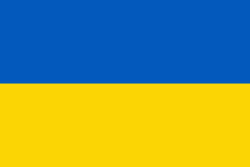
Country - Ukraine
 |
 |
| Flag of Ukraine | |
During the Middle Ages, Ukraine was the site of early Slavic expansion and the area later became a key centre of East Slavic culture under the state of Kievan Rus', which emerged in the 9th century. The state eventually disintegrated into rival regional powers and was ultimately destroyed by the Mongol invasions of the 13th century. The area was then contested, divided, and ruled by a variety of external powers for the next 600 years, including the Polish–Lithuanian Commonwealth, the Austrian Empire, the Ottoman Empire, and the Tsardom of Russia. The Cossack Hetmanate emerged in central Ukraine in the 17th century, but was partitioned between Russia and Poland, and ultimately absorbed by the Russian Empire. Ukrainian nationalism developed, and following the Russian Revolution in 1917, the short-lived Ukrainian People's Republic was formed. The Bolsheviks consolidated control over much of the former empire and established the Ukrainian Soviet Socialist Republic, which became a constituent republic of the Soviet Union when it was formed in 1922. In the early 1930s, millions of Ukrainians died in the Holodomor, a man-made famine. During World War II, Ukraine was devastated by the German occupation.
Currency / Language
| ISO | Currency | Symbol | Significant figures |
|---|---|---|---|
| UAH | Ukrainian hryvnia | â‚´ | 2 |
| ISO | Language |
|---|---|
| HU | Hungarian language |
| PL | Polish language |
| RU | Russian language |
| UK | Ukrainian language |